![]()

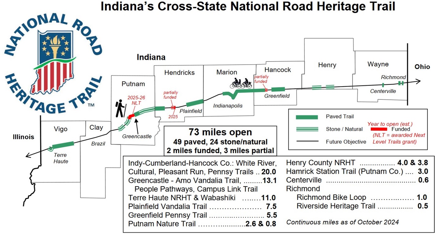
Click on map above for printable PDF version.
Updated 7/7/2025
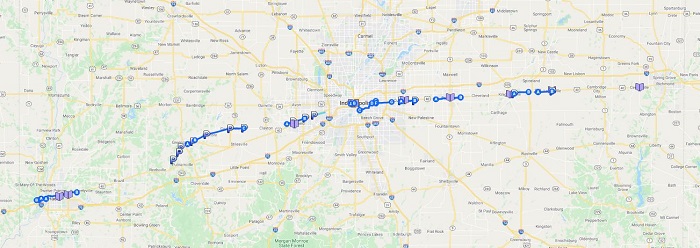
The map linked above can be used for real-time navigation in the Google Maps app on your mobile GPS-enabled device. To set up the first time, use the steps below. After that, you only need to click on the map above or open it from "Your places" in Google Maps. This will not provide automatic turn-by-turn instructions, but will be overlaid on the background map, so your location relative to the defined route will be easily visible.
First Time Set-Up for Real Time Navigation
1) On your computer or
Android device, click on the map above while
signed in to your Google account.
2) If prompted "Open with", click on "Google
My Maps".
3) On your mobile device
(Android or iPhone/iPad), open the Google
Maps app.
4) In the top left part of
the screen, click on the 3 horizontal lines
in the left end of the Search bar.
5) Click on "Your places".
6) Under "Your places",
scroll to the right and click on MAPS.
7) Click on "NRHT -
cross-Indiana".
8) All of the NRHT segments will now be
visible on the navigation map.
9) When GPS is turned on, your location
relative to this route will be easily
visible. (Since Googlemaps
may choose a different route than these
trails between any two particular points
& since some trail segments are not
yet in Googlemaps, automatic routing with
turn-by-turn instructions will not
necessarily be possible.)
Please
let us know (info@nrht.org) if you have any
questions or problems with this process.
Printable Local Maps: (under construction)